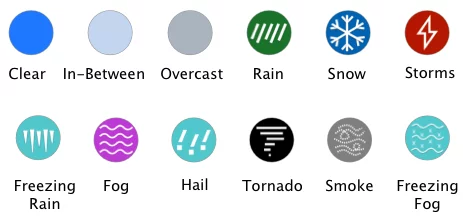
The map below shows the I-20 weather conditions and weather radar for the next 6 hours. Interstate 20 is 1,539 miles long running east/west along the southern states in the U.S. I20 begins near Kent, Texas and ends in Florence, South Carolina in the east.
Spanning from Texas to South Carolina I-20 passes through several big cities along the route such as Dallas, Shreveport, Jackson, Birmingham, Atlanta, Augusta and Columbia.
Copyright 2025 Concept Elements LLC. | Privacy Policy | EULA
| Cookie | Duration | Description |
|---|---|---|
| cookielawinfo-checbox-analytics | 11 months | This cookie is set by GDPR Cookie Consent plugin. The cookie is used to store the user consent for the cookies in the category "Analytics". |
| cookielawinfo-checbox-functional | 11 months | The cookie is set by GDPR cookie consent to record the user consent for the cookies in the category "Functional". |
| cookielawinfo-checbox-others | 11 months | This cookie is set by GDPR Cookie Consent plugin. The cookie is used to store the user consent for the cookies in the category "Other. |
| cookielawinfo-checkbox-necessary | 11 months | This cookie is set by GDPR Cookie Consent plugin. The cookies is used to store the user consent for the cookies in the category "Necessary". |
| cookielawinfo-checkbox-performance | 11 months | This cookie is set by GDPR Cookie Consent plugin. The cookie is used to store the user consent for the cookies in the category "Performance". |
| viewed_cookie_policy | 11 months | The cookie is set by the GDPR Cookie Consent plugin and is used to store whether or not user has consented to the use of cookies. It does not store any personal data. |