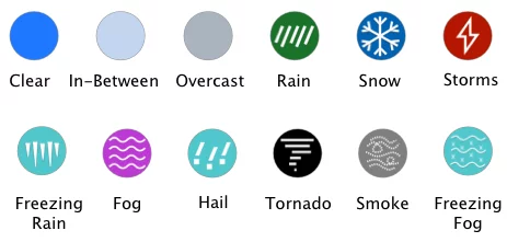
This map shows I-45 Weather, radar, and forecast conditions. Interstate 45 is a major artery for Texas travel and commuting, therefore, accurate knowledge of I-45 weather conditions is necessary. An original Interstate Highway commissioned in 1962 stretching 286 miles to connect the Texas Gulf Coast city of Galveston, on Galveston Island, to the metropolis of Dallas, Texas.
After crossing the Galveston Crossway Bridge south of Houston, the I-45 freeway passes by NASA’s Johnson Space Center and Mission Control. North of Houston I-45 transitions to a rural freeway through the Sam Houston National Forest and remains rural until Corsicana, Texas south of Dallas. Once in Dallas/Fort Worth area I45 connects to several major interstate highways like I-20, I-30 and I-35 providing a traveler with connections to middle America and the west coast.
Copyright 2025 Concept Elements LLC. | Privacy Policy | EULA
| Cookie | Duration | Description |
|---|---|---|
| cookielawinfo-checbox-analytics | 11 months | This cookie is set by GDPR Cookie Consent plugin. The cookie is used to store the user consent for the cookies in the category "Analytics". |
| cookielawinfo-checbox-functional | 11 months | The cookie is set by GDPR cookie consent to record the user consent for the cookies in the category "Functional". |
| cookielawinfo-checbox-others | 11 months | This cookie is set by GDPR Cookie Consent plugin. The cookie is used to store the user consent for the cookies in the category "Other. |
| cookielawinfo-checkbox-necessary | 11 months | This cookie is set by GDPR Cookie Consent plugin. The cookies is used to store the user consent for the cookies in the category "Necessary". |
| cookielawinfo-checkbox-performance | 11 months | This cookie is set by GDPR Cookie Consent plugin. The cookie is used to store the user consent for the cookies in the category "Performance". |
| viewed_cookie_policy | 11 months | The cookie is set by the GDPR Cookie Consent plugin and is used to store whether or not user has consented to the use of cookies. It does not store any personal data. |