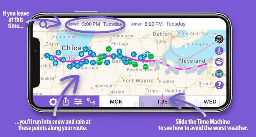
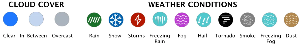
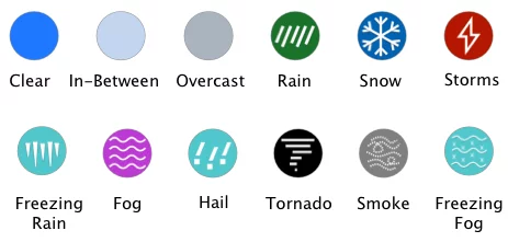
This map shows the weather conditions, radar and forecast information for Canada Highway 97.
Canada Highway 97 travels through British Columbia. It is 2,081 km (1,293 mi) long, making it the longest highway in any Canadian province as well as being the longest continuously numbered route. Beginning in Osoyoos, British Columbia in the southern near the American border, running north through the entire province of British Columbia ending in the far north region of the Yukon territory at Watson Lake near the Alaskan border.
Connecting at the international border, Highway 97 takes its number from U.S. Route 97 and is made up of several different highways along the length of its route. The highways include: Okanagan Highway, Vernon-Kamploops-Cache-Creek Highway, Cariboo Highway, John Hart Highway, and Alaska Highway. Along the beautiful and scenic route of Canada Highway 97 you will pass by gorgeous bodies of water like, Okanagan Lake passing over on the Willian R. Bennett Bridge, Frasier River, Wood Lake, Kalamalka Lake, Cache Creek, Thompson River and many others. Traveling along this winding corridor you will experience a tree-lined highway of lush forests of evergreens with cascading mountain views.
The final stretch of Highway 97 is part of the Alaska Highway. This section is 965 km (600 mi) long and sparsely populated traveling through only two towns along the way.
We use cookies on our website to give you the most relevant experience by remembering your preferences and repeat visits. By clicking “Accept”, you consent to the use of ALL the cookies.
This website uses cookies to improve your experience while you navigate through the website. Out of these, the cookies that are categorized as necessary are stored on your browser as they are essential for the working of basic functionalities of the website. We also use third-party cookies that help us analyze and understand how you use this website. These cookies will be stored in your browser only with your consent. You also have the option to opt-out of these cookies. But opting out of some of these cookies may affect your browsing experience.
Necessary cookies are absolutely essential for the website to function properly. These cookies ensure basic functionalities and security features of the website, anonymously.
Cookie
Duration
Description
cookielawinfo-checbox-analytics
11 months
This cookie is set by GDPR Cookie Consent plugin. The cookie is used to store the user consent for the cookies in the category "Analytics".
cookielawinfo-checbox-functional
11 months
The cookie is set by GDPR cookie consent to record the user consent for the cookies in the category "Functional".
cookielawinfo-checbox-others
11 months
This cookie is set by GDPR Cookie Consent plugin. The cookie is used to store the user consent for the cookies in the category "Other.
cookielawinfo-checkbox-necessary
11 months
This cookie is set by GDPR Cookie Consent plugin. The cookies is used to store the user consent for the cookies in the category "Necessary".
cookielawinfo-checkbox-performance
11 months
This cookie is set by GDPR Cookie Consent plugin. The cookie is used to store the user consent for the cookies in the category "Performance".
viewed_cookie_policy
11 months
The cookie is set by the GDPR Cookie Consent plugin and is used to store whether or not user has consented to the use of cookies. It does not store any personal data.
Functional cookies help to perform certain functionalities like sharing the content of the website on social media platforms, collect feedbacks, and other third-party features.
Performance cookies are used to understand and analyze the key performance indexes of the website which helps in delivering a better user experience for the visitors.
Analytical cookies are used to understand how visitors interact with the website. These cookies help provide information on metrics the number of visitors, bounce rate, traffic source, etc.
Advertisement cookies are used to provide visitors with relevant ads and marketing campaigns. These cookies track visitors across websites and collect information to provide customized ads.