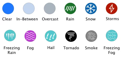
I55 weather shows the current conditions and forecast for the I55 corridor from Chicago and Springfield in Illinois, St Louis Missouri, Memphis Tennessee, Jackson Mississippi, to New Orleans Louisiana.
I-55 is 964 miles long making it the 14th longest interstate in America and the 7th longest north-south highway. I-55 is one of the main routes across the central United States. Connecting the Gulf of Mexico to the Great Lakes, and allows travelers to journey from Chicago, Illinois to Louisiana. It was originally constructed in the 1960s but reached completion in 1979.
I 55 sits just east of Tornado Alley. Here are some popular locations you can visit along the way:
Copyright 2025 Concept Elements LLC. | Privacy Policy | EULA
| Cookie | Duration | Description |
|---|---|---|
| cookielawinfo-checbox-analytics | 11 months | This cookie is set by GDPR Cookie Consent plugin. The cookie is used to store the user consent for the cookies in the category "Analytics". |
| cookielawinfo-checbox-functional | 11 months | The cookie is set by GDPR cookie consent to record the user consent for the cookies in the category "Functional". |
| cookielawinfo-checbox-others | 11 months | This cookie is set by GDPR Cookie Consent plugin. The cookie is used to store the user consent for the cookies in the category "Other. |
| cookielawinfo-checkbox-necessary | 11 months | This cookie is set by GDPR Cookie Consent plugin. The cookies is used to store the user consent for the cookies in the category "Necessary". |
| cookielawinfo-checkbox-performance | 11 months | This cookie is set by GDPR Cookie Consent plugin. The cookie is used to store the user consent for the cookies in the category "Performance". |
| viewed_cookie_policy | 11 months | The cookie is set by the GDPR Cookie Consent plugin and is used to store whether or not user has consented to the use of cookies. It does not store any personal data. |