Highway 16 Canada Weather: What to Expect on the Yellowhead Route
Highway 16 traverses Western Canada in British Columbia. It starts at Prince Rupert on the Pacific spanning 1,173 km (729 mi) to arrive in Winnipeg, Manitoba. It is a scenic route winding through the Cost Mountains while traveling along the paths of the Skeena and Bulkley Rivers. In addition to these views, Highway 16 also passes through the Naikoon and Mt. Robson Provincial Parks.
Highway 16, also known as the Yellowhead Highway, is a major east-west route stretching across western Canada—from Prince Rupert, British Columbia to Winnipeg, Manitoba. Spanning through British Columbia, Alberta, Saskatchewan, and Manitoba, it crosses diverse terrain and climates, making Canada Highway 16 weather an important factor for safe and efficient travel.
Weather Conditions Along Highway 16
British Columbia (Prince Rupert to Jasper):
The western stretch of Highway 16 passes through coastal rainforests and mountainous terrain. Rain is frequent, especially near Prince Rupert and Smithers, and snow is common in winter. Avalanche warnings may be issued in mountainous areas near the Rockies, particularly around the Yellowhead Pass.
Alberta (Jasper to Lloydminster):
As the highway enters the Rocky Mountain foothills and Edmonton area, winters bring snow, icy roads, and frigid temperatures. Alberta is known for sudden weather shifts—high winds and snow squalls can occur with little warning. In summer, travelers may encounter severe thunderstorms and occasional hail.
Saskatchewan (Lloydminster to Yorkton):
Highway 16 crosses the Prairies, where weather is typically dry but can be extreme. Bitter cold and blowing snow affect visibility in winter, while spring and summer bring powerful winds, dust storms, and isolated thunderstorms.
Manitoba (Russell to Winnipeg):
The eastern stretch features humid continental weather. Winter ice and snow can impact travel from November to March. Summer storms are frequent and sometimes include hail or lightning near Winnipeg.
Travel Tips for Highway 16 Weather
Check road and weather conditions before driving, especially in winter or early spring.
Carry winter tires or chains during the colder months.
Watch for fog, wildlife, and black ice, particularly in remote stretches.
Plan extra time if driving through mountain passes or during active storm systems.
Useful Resources
DriveBC – Road conditions and live highway cameras (BC section).
Manitoba 511 – Manitoba road conditions and closures.
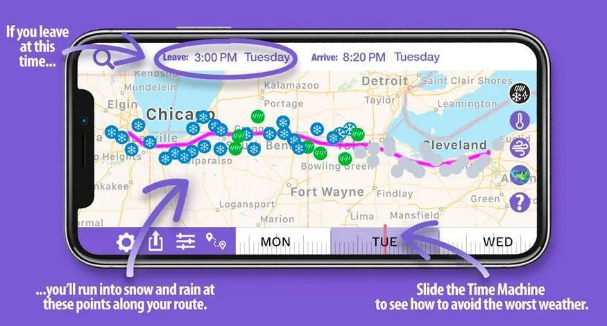
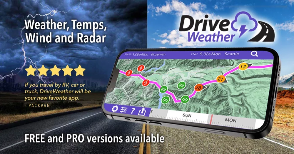
Use weather apps like The Weather Network, AccuWeather, or Drive Weather to monitor real-time forecasts.
Stay safe on the Yellowhead Highway by staying weather-aware. Whether you’re road tripping, hauling freight, or commuting across provinces, Highway 16 demands respect for its seasonal weather extremes.
We use cookies on our website to give you the most relevant experience by remembering your preferences and repeat visits. By clicking “Accept”, you consent to the use of ALL the cookies.
This website uses cookies to improve your experience while you navigate through the website. Out of these, the cookies that are categorized as necessary are stored on your browser as they are essential for the working of basic functionalities of the website. We also use third-party cookies that help us analyze and understand how you use this website. These cookies will be stored in your browser only with your consent. You also have the option to opt-out of these cookies. But opting out of some of these cookies may affect your browsing experience.
Necessary cookies are absolutely essential for the website to function properly. These cookies ensure basic functionalities and security features of the website, anonymously.
Cookie
Duration
Description
cookielawinfo-checbox-analytics
11 months
This cookie is set by GDPR Cookie Consent plugin. The cookie is used to store the user consent for the cookies in the category "Analytics".
cookielawinfo-checbox-functional
11 months
The cookie is set by GDPR cookie consent to record the user consent for the cookies in the category "Functional".
cookielawinfo-checbox-others
11 months
This cookie is set by GDPR Cookie Consent plugin. The cookie is used to store the user consent for the cookies in the category "Other.
cookielawinfo-checkbox-necessary
11 months
This cookie is set by GDPR Cookie Consent plugin. The cookies is used to store the user consent for the cookies in the category "Necessary".
cookielawinfo-checkbox-performance
11 months
This cookie is set by GDPR Cookie Consent plugin. The cookie is used to store the user consent for the cookies in the category "Performance".
viewed_cookie_policy
11 months
The cookie is set by the GDPR Cookie Consent plugin and is used to store whether or not user has consented to the use of cookies. It does not store any personal data.
Functional cookies help to perform certain functionalities like sharing the content of the website on social media platforms, collect feedbacks, and other third-party features.
Performance cookies are used to understand and analyze the key performance indexes of the website which helps in delivering a better user experience for the visitors.
Analytical cookies are used to understand how visitors interact with the website. These cookies help provide information on metrics the number of visitors, bounce rate, traffic source, etc.
Advertisement cookies are used to provide visitors with relevant ads and marketing campaigns. These cookies track visitors across websites and collect information to provide customized ads.