I-75 weather shows weather for cities along I-75 including Detroit Michigan, Toledo, Dayton, Cincinnati Ohio, Lexington Kentucky, Knoxville and Chattanooga Tennessee, Atlanta and Macon Georgia, Gainesville, Tampa, Fort Meyers, Naples, and Miami Florida. As the second longest north-south highway in the nation at 1,786 miles long there are many different weather conditions I-75.
Though it was originally supposed to stop at Tampa, the Interstate Highway System elected to extend the I-75 to Miami. The cost was estimated to be over $3 million to finish the original section of I-75, but the final section, named Alligator Alley, wasn’t completed until 1992.
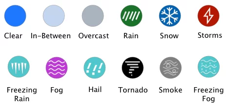
It’s hard to say what kind of weather conditions you can expect along I-75. For example, when you enter each state, you may experience heavy rain, chilling snow storms, or tropical light rain. The overcast clouds of Michigan give way to a few clouds as you travel south towards Florida.
The southern states (parts of Kentucky, Georgia, and Florida) along the I-75 tend to receive rain and similar weather conditions related to high humidity levels. Moderate rain may occur as winter turns to spring. Then again, you might wake up to a clear sky in the morning and walk out to overcast clouds and wind just a few hours later.
Weather might be breezy and balmy in Miami, but along other parts of Interstate 75, the weather conditions might not be so pleasant. That’s why you should always have a reliable weather app you can refer to when the sun hides behind the clouds and the wind starts to pick up.
The Drive Weather App is free to download. It provides travelers from all cities along I-75 the chance to see what’s ahead of them to prepare for the journey to come. If you’re traveling along I-75 and want to make sure you stay head of the bad weather, the Drive Weather App should be the first thing you download.
The free version of the Drive Weather App will give you a forecast of the weather for up to 2 days in advance. However, you can toggle to 7 days of forecast in advance if you choose to pay for the Pro Version. This only costs you $12 per year (which is $1 per month) and can truly save you time and headache along your journey on Interstate 75.
Give the Drive Weather App a try on your next journey and see how you can keep an eye on the temperature, weather conditions, wind, and radar. It might just be the app you need to complete your journey safely.
Copyright 2026 Concept Elements Inc. | Privacy Policy | EULA
| Cookie | Duration | Description |
|---|---|---|
| cookielawinfo-checbox-analytics | 11 months | This cookie is set by GDPR Cookie Consent plugin. The cookie is used to store the user consent for the cookies in the category "Analytics". |
| cookielawinfo-checbox-functional | 11 months | The cookie is set by GDPR cookie consent to record the user consent for the cookies in the category "Functional". |
| cookielawinfo-checbox-others | 11 months | This cookie is set by GDPR Cookie Consent plugin. The cookie is used to store the user consent for the cookies in the category "Other. |
| cookielawinfo-checkbox-necessary | 11 months | This cookie is set by GDPR Cookie Consent plugin. The cookies is used to store the user consent for the cookies in the category "Necessary". |
| cookielawinfo-checkbox-performance | 11 months | This cookie is set by GDPR Cookie Consent plugin. The cookie is used to store the user consent for the cookies in the category "Performance". |
| viewed_cookie_policy | 11 months | The cookie is set by the GDPR Cookie Consent plugin and is used to store whether or not user has consented to the use of cookies. It does not store any personal data. |